Hidden Hill Stations of Kannur: Nature’s Best-Kept Secrets
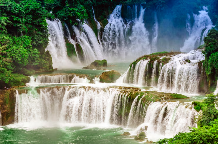
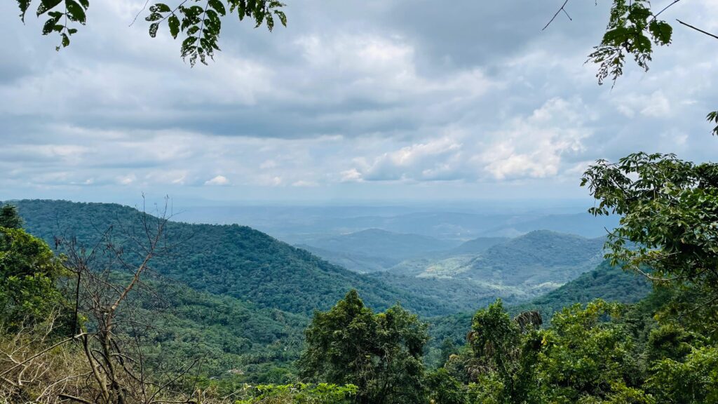
HILL STATIONS IN KANNUR A Journey Through the Western Ghats Hidden View Points & Hill Stations in Kannur When you think of Kerala, backwaters and beaches usually come to mind — but Kannur hides some of the most stunning, lesser-known hill stations and viewpoints in the Western Ghats. Mist-covered peaks, sacred pilgrim trails, quaint villages, and panoramic valleys make these spots a perfect retreat for nature lovers and trekkers. Here’s your complete guide to the hidden hill stations in Kannur:Mount Kottathalachi, Palukachippara, Sasippara, Kalanki, Chathamangalam, Thabore, Josegiri, and Manakadavu–Coorg Border. Mount Kottathalachi (Christian Pilgrim Hill) Height: ~2,700 feet above sea level. A Christian pilgrim center, also called Kurisumala. The Holy Cross was installed on Good Friday, 1958 by Fr. Mathew Mannuramparambil. Small chapel dedicated to Thomas (Kurisumala Muthappan) at the top. Famous for sunrise and sunset views, with a bird’s-eye view of Kannur and Kasaragod towns. How to Reach Jeep road available up to Anakuzhi (midway). Most popular route: Vazhakundam–Choorappadavu Road (via Pulingome, Cherupuzha Panchayat). Distance: Cherupuzha to Pulingome – 7 km. From Choorappadavu–Kottathalachi junction, take the left road leading uphill. Travel Assistance Contact: Kottathalachi Development Society helpline – 8848953001 Best Time to Visit Throughout the year; especially during Easter season pilgrimages. Early morning or evening for best views. Palukachippara Known for ancient rocks (millions of years old) in unique shapes. Scenic waterfalls, best during monsoon. Excellent trekking trails with breathtaking valley views. Rich cultural heritage with the Palukachippara Kottam Temple (14th century, dedicated to Lord Shiva). How to Reach 30 km from Kannur town. By Air: Kannur International Airport (~66 km). By Rail: Kannur Railway Station (~49 km). Taxis and buses available from Kannur town. Best Time to Visit Monsoon Magic (June to September): The hills are lush green, and the waterfalls are at their most spectacular. Perfect for nature photography and scenic views. Post-Monsoon Charm (October to November): The landscape remains vibrant, with pleasant weather and clear skies, ideal for trekking and outdoor exploration. Tips Wear sturdy shoes; paths may be slippery. Carry rain gear during monsoon. Start early for best views. Bring water and snacks. Sasippara Viewpoint (Kanjirakolli) History The name “Sasippara” comes from Malayalam: Sasi (moon) + Para (rock).Known for its moon-like rock formations and serene atmosphere. Timings Open daily: 9:00 AM – 5:00 PM. Height: Approximately 4,000 feet above sea level. Views: Offers breathtaking panoramic views of the Western Ghats and surrounding valleys. Best Time: Sunrise and sunset are the most popular for spectacular views. Wildlife & Nature: Rich biodiversity makes it ideal for birdwatching and nature enthusiasts. Nearby Attraction: Alakapuri Waterfalls is just 4 km away, perfect for a short trek or day trip. How to Reach 60 km from Kannur town. By Air: Kannur International Airport (~60 km). By Rail: Kannur Railway Station (~60 km). By Bus: KSRTC buses run from Kannur/Taliparamba to Sreekandapuram. From there, taxis can be hired. Entry Fee Indian Adults: ₹50 Indian Children: ₹20 Foreign Adults: ₹250 Foreign Children: ₹200 Tips Wear comfortable shoes. Carry snacks and water. Visit early morning or late afternoon for best breeze and views. Kalanki – The Queen of Hills Location: One of the highest regions in Kannur district, near the Karnataka border. Scenery: Famous for mist-covered hills, dense forests, and stunning sunrises and sunsets. Views: Panoramic vistas include Kannur International Airport and the Iritty River from select vantage points. Cultural Spot: Home to the serene Kalanki Temple, adding a spiritual touch to the visit. How to Reach Address: Kalanki PO, Mattara–Kalanki Road, Ullikkal, Kerala – 670705. Distance: ~58 km from Kannur (via Iritty → Ulikkal → Mattara). Also accessible from Karnataka side via Koottupuzha–Aanakuzhi. Best Time To Visit Early morning or evening for sunrise/sunset. Winter (Nov–Feb) for misty weather. Tips Wear comfortable shoes. Carry snacks and water. Visit early morning or late afternoon for best breeze and views. Chathamangalam Hills (Theruvamala) Located near Cherupuzha, Alakode, and Udayagiri Panchayats. Peaks: Theruvamala & Thevarkunnumala (~2,500 m above sea level). Scenic views of villages, forests, and valleys. Known as a “ghost village” due to depopulation. Jude’s Shrine is a local landmark. How to Reach 58 km from Kannur HQ. Routes: Kannur → Taliparamba → Alakode → Neduvode → Chathamangalam. Or Kannur → Payyannur → Cherupuzha → Thirumeni → Chathamangalam. Best Time To Visit Monsoon & winter (lush greenery, mist, seasonal waterfalls). Tips Poor road conditions. Limited facilities and shops. Wildlife presence (monkeys, wild boars, etc.). Thabore Hilltop A hilltop village with a Christ the Redeemer statue at the summit. Requires ~2 km hike from base to reach the statue. Offers wide valley and mountain views, best at sunset. Birdwatching opportunities at the grasslands. How to Reach Address: Thabore–Kottathalachi Road, Tabore, Kerala – 670511. Distance: ~60 km from Kannur. Nearby towns: Cherupuzha (~13 km) and Alakode Best Time To Visit Evening (for sunset). Post-monsoon for clearer skies. Tips Wear good hiking shoes. Carry water — no shops at the top. Avoid descending after dark Josegiri Viewpoint (Thirunettikallu) Located in Josegiri village, Cherupuzha Panchayat. Altitude: ~2,300 ft. Attractions: Thirunettikallu viewpoint. Rolling stone trapped between boulders. A large cross atop a rock (climbable with a ladder). Misty meadows, medicinal herbs, and wildflowers. How to Reach Route: Kozhichal–Rajagiri–Josegiri Road. From Josegiri, 2 km trek to viewpoint (last stretch is steep). Best Time To Visit Early morning (mist and sunrise). Late afternoon for sunset. Post-monsoon (green landscapes). Tips Visit early morning for misty sunrises and clear views Wear good hiking shoes. Carry water — no shops at the top. Avoid descending after dark Manakadavu–Coorg Border Border point where Kerala meets Karnataka. Marked by a small bridge and a river/stream, believed to be the origin of the Kuppam River. Locally called Vaikkamba/Vaikamba. Surrounded by forests, streams, and hills. Restrictions The Karnataka side is protected forest — tourists cannot cross into it. Best For Short drives, nature trails, photography Conclusion Kannur’s hill stations and viewpoints are a refreshing escape into the lap of the Western Ghats. From sacred pilgrim peaks like Kottathalachi to the serene valleys of Josegiri, from the misty